
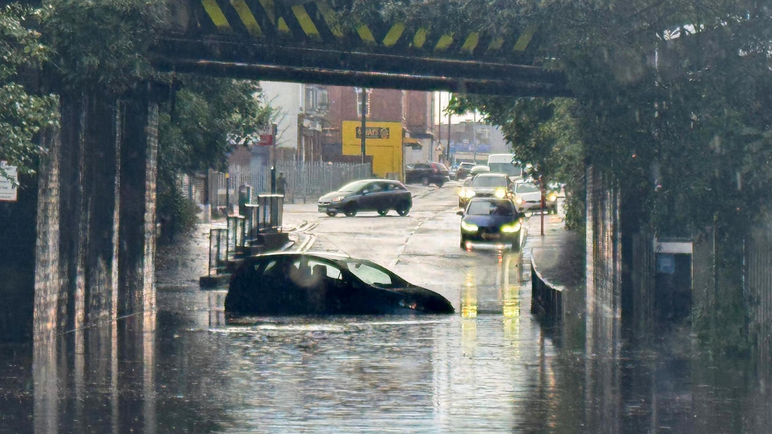
Forecasters are warning that a series of powerful weather systems is expected to move across portions of the Midwest and Southeast over the coming weekend, bringing the potential for damaging winds, large hail, and intense rainfall. Meteorologists are closely monitoring the evolving patterns, noting that a clash between warm, humid air from the Gulf of Mexico and cooler air from the north is creating a setup ripe for strong to severe storms.
As the weekend approaches, atmospheric conditions are aligning in a way that could produce multiple rounds of severe weather in several states. The primary concern is the potential for organized thunderstorms that may develop into supercells, which can bring hazardous wind gusts capable of toppling trees, downing power lines, and causing structural damage. In some areas, the risk of hailstones large enough to damage vehicles and rooftops is also significant.
The Midwest is anticipated to experience the initial surge of storms, likely starting late Friday and strengthening by Saturday. Regions like Missouri, Illinois, and Indiana could encounter isolated severe thunderstorms that might rapidly become more widespread, particularly during the hottest parts of the afternoon and evening. Locals are encouraged to remain aware of regional warnings and get ready for shifting weather situations, as rapidly forming storms can provide limited reaction time.
For the weekend, particularly from Saturday night to Sunday, the storm is expected to move towards the Southeast, affecting areas in Kentucky, Tennessee, Alabama, Georgia, and the Carolinas. The presence of humid and unstable air in these areas heightens the chances of intense rainfall and the potential for sudden flooding, especially in low-lying regions or neighborhoods close to rivers and streams. Emergency management authorities stress the importance of having various methods for receiving weather warnings, such as mobile notifications and NOAA weather radios, particularly during nighttime when individuals might be asleep.
Furthermore, alongside the risk of strong winds and hail, meteorologists caution that isolated tornadoes remain a possibility. Although the likelihood of developing tornadoes is deemed lower compared to the chance of straight-line wind damage, the unpredictable nature of supercell formation means that short-lived, localized tornadoes might still occur. These phenomena can still pose significant danger, potentially leading to injuries and damage to properties, especially if they land unexpectedly.
Meteorologists from the National Weather Service and private forecasting agencies are working to refine their models in real-time, adjusting predicted storm tracks and severity levels as new data comes in. Weather balloon launches, satellite imagery, and Doppler radar observations are all being utilized to monitor the development of these storm systems. Early indications suggest that the severe weather risk will vary across the affected regions, with some areas likely seeing only heavy rain while others may endure more destructive conditions.
For agricultural workers throughout the Midwest and Southeast, the incoming storms bring both difficulties and possible advantages. Although the rain might offer essential hydration for plants in specific regions, powerful winds, hail, and flooding could lead to major farming setbacks. Corn, soybeans, and wheat fields are particularly at risk of damage from hail, which can tear through leaves and lower production. Farmers with livestock should also take steps to brace for adverse weather conditions, making sure animals have protection and that there are backup plans established.
Transportation may be affected as well, especially for individuals traveling long distances by car or passing through significant hub locations within the impacted regions. Intense rainfall has the potential to create dangerous driving situations, and high winds might cause disruptions to flight timetables at airports in cities like St. Louis, Nashville, and Atlanta. It is advisable for travelers to stay updated on weather predictions and keep travel plans flexible due to the possibility of unexpected weather-related delays.
Communities with a history of storm damage are taking the forecasts seriously. Local officials in some towns are already preparing emergency shelters and reviewing disaster response plans. Utility companies are also on alert, readying crews to respond quickly to potential power outages caused by falling trees and wind damage to transmission lines.
Although the storms are expected to clear up in a few days, their effects might linger, especially if there is extensive damage or significant flooding. Cleanup operations might take several days or even weeks, influenced by the severity of the storm and the resources allocated for recovery. Insurance claims could also rise, notably for damage caused by hail and wind, as property owners and companies evaluate the impact.
Specialists emphasize that being well-prepared is the most effective protection against harsh weather conditions. They advise anchoring any objects outdoors that might be carried away by the wind, confirming that emergency supplies contain necessary items, and establishing a clear strategy for finding refuge. For families residing in mobile homes or older buildings, pinpointing more robust structures nearby to move to during storms can be crucial for safety.
The upcoming weekend serves as a reminder that severe weather season is not confined to the traditional “storm alley” states. With shifting climate patterns, intense storms can strike across a wide swath of the country, and being informed and ready is essential. Forecasters will continue to update the public as conditions evolve, urging vigilance and swift action when warnings are issued.
Although not all communities in the Midwest and Southeast are set to face intense effects, the extensive range of the threat implies that many people need to stay informed about evolving conditions from Friday to Sunday. Whether using weather applications, regional news broadcasts, or emergency notification systems, maintaining a connection to trustworthy information sources will be crucial for safety as the weekend storms develop.